Directions
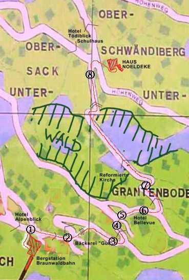
After leaving the funicular, take the stone staircase to the small square above the station building and continue slightly uphill on the paved road towards the village shop (right), Volg (left), and Bakery Gut [approx. 100m].
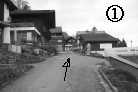
To the left of Bakery Gut, take the steep, cobblestone footpath [approx. 100m] until you reach the paved road again.
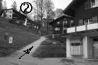
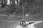
Continue along this road [100m], slightly uphill between the former photography shop Barbier, now a private house with brown wood (right) and the rose garden (left) until the junction.
Then continue left under the Hotel Bellevue, slightly uphill.
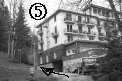
Finally, go left around the Hotel Bellevue [200m].
Behind the Hotel Bellevue, first level, then behind the tennis court (ice rink in winter), turn left onto the now only natural path uphill [50m].
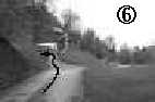
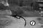
Continue quite steeply uphill in left-right-left curves [Photo 7] on the natural path until it leads into the forest above the faintly visible Protestant church through the trees [300m]. Continue straight through the forest, moderately uphill, until you leave the forest again in a steep right-left zigzag curve. From there, continue to the soon visible schoolhouse [300m].
From the schoolhouse junction [Photos 8 and 9], take the level natural path to the right [20m] and immediately cross [Photo 9] the meadow (at the latest by the hydrant gnome "Däv") up to the house [15m].

